3. Real Cases
Real cases are performed by dynamically downscaling from a mesoscale model such as WRF that can provide initial and boundary conditions for a one-way nested FastEddy simulation. These mesoscale-LES coupled simulations require the following preprocessing steps:
Step 1: GeoSpec. Georeference specification step. Expects a NetCDF-formatted file of location-specific, georeferenced coordinate frame (lat/lon), projected Cartesian coordinate frame (x,y), elevation and land cover to establish a new NetCDF file of reference geolocated domain static characteristics specification including mapping of land cover category to roughness length.
Step 2: SimGrid. Simulation grid definition step. Defines a FastEddy gridded domain at a specificed grid spacing, location and extent using the file resulting from ther previous GeoSpec step and a FastEddy input parameters file (with targeted domain configuration parameters) as inputs.
Step 3: GenICBCs. Generate initial conditions/boundary (ICBCs) conditions step. Creates ICBCs for a targeted FastEddy domain (defined in the SimGrid step) from a set of mesoscale model results.
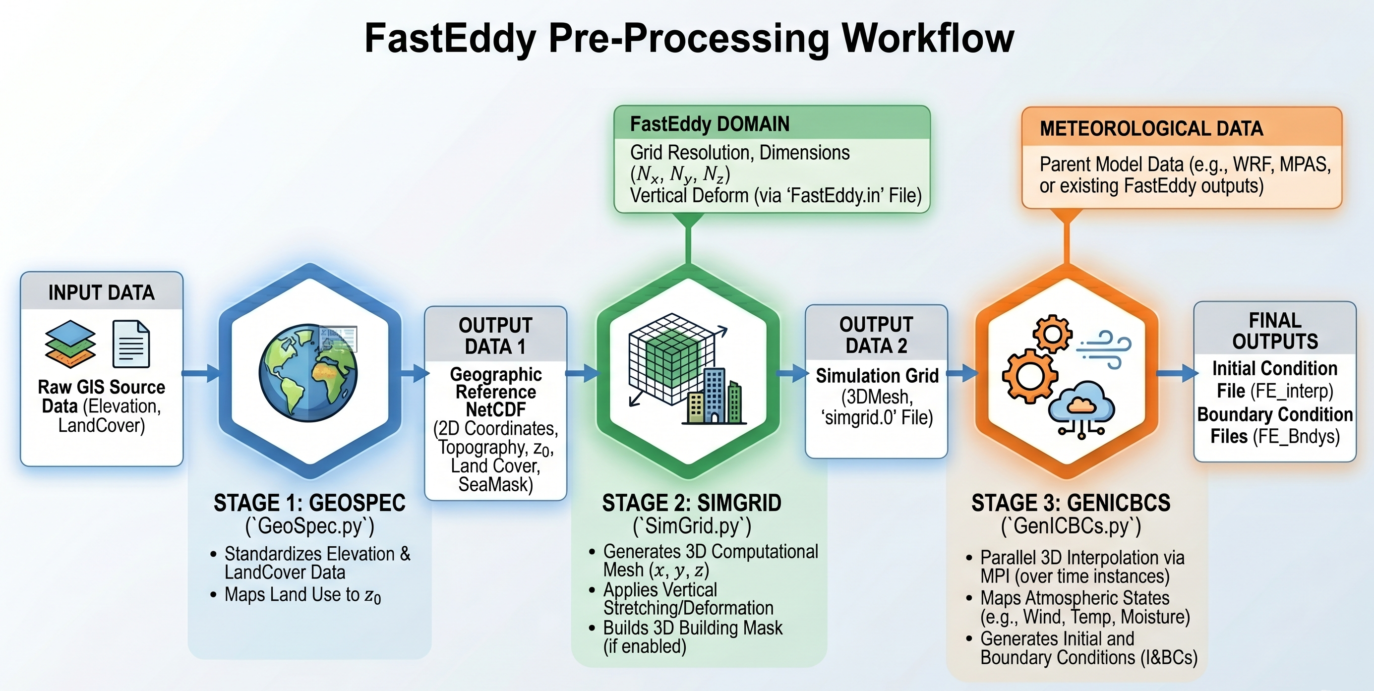
Figure 3.1 FastEddy Pre-Processing Workflow Diagram*
The following tutorial provides a practical example of performing these preprocessing steps followed by a corresponding weather-driven FastEddy simulation for a real-world downscaled scenario.
* Source: Google. (2026). Gemini (Version 3 Flash) [Large language model]. https://gemini.google.com